Ruins in the Snow: The Forgotten Checkpoints and Vanished Cabins Hidden Along the Quest Trail
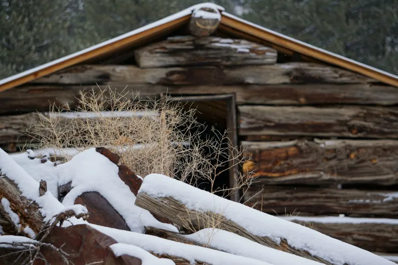
Somewhere along a frozen stretch of the Yukon River, half-buried under a decade's worth of drifted snow, there's a cabin that used to matter. Its logs have shifted. Its roof sags in the middle. The hand-painted sign that once marked it as an official checkpoint is long gone, probably taken by a souvenir hunter or simply rotted away. But if you knew what you were looking at — if you slowed your sled and actually paid attention — you'd see it for what it is: a ghost of the early Yukon Quest, still standing watch over a trail that has moved on without it.
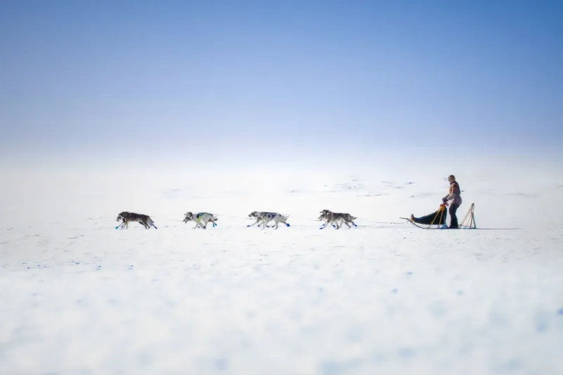
The Quest has been running since 1984. That's four decades of route tweaks, logistical pivots, and hard-learned lessons about where you can and can't reliably support a thousand-mile sled dog race through some of the most unforgiving terrain on earth. Along the way, a handful of checkpoints have come and gone. Cabins that once served as critical rest stops have been swallowed by the wilderness. And the stories attached to those places have mostly faded from public memory — kept alive mainly by old-timers, local historians, and the occasional musher who's curious enough to ask questions.
This is about those places. And what they tell us about how the race has evolved.
Why Checkpoints Get Abandoned
It's easy to assume that the Yukon Quest route is fixed — that the same trail the first mushers ran in 1984 is the one being raced today. It isn't. The route has shifted meaningfully over the years, driven by a mix of practical and political factors.
Some checkpoints were dropped because the communities they were tied to couldn't sustain the infrastructure demands of a major race. Hosting a Quest checkpoint isn't a small ask. You need volunteers, food storage, veterinary support, communications equipment, and enough physical space to accommodate teams arriving at all hours in brutal cold. For small, remote communities — especially those without reliable road access — that's a serious lift. When the volunteer base dried up or local enthusiasm waned, race organisers had to adapt.
Other waypoints were casualties of route changes driven by safety or trail conditions. A stretch that worked fine in the 1980s might become impassable as river ice patterns shift, or as the boreal landscape changes around it. The race has always had to thread a needle between tradition and pragmatism, and sometimes that means leaving a checkpoint behind.
There's also the straightforward issue of infrastructure decay. Cabins that served as emergency shelters or informal rest stops in the early years weren't built to last forever. Without regular maintenance — and without the funding or mandate to keep them up — they deteriorate fast in the Yukon climate. A structure that was solid in 1990 can be genuinely dangerous by 2005.
The Cabins That Remain
What's remarkable is how many of these structures are still out there, in some form. The Yukon is full of historic cabins — built by trappers, prospectors, and Indigenous travellers long before the Quest existed — and the race trail has always woven through that existing network. Some of those cabins were formally incorporated into early race logistics. Others were simply known to mushers as emergency options, part of an informal safety net that experienced racers carried in their heads.
A few of the most historically significant structures are now protected under Yukon heritage legislation, which limits what can be done with them but at least ensures they won't be torn down. Others exist in a kind of legal grey zone — on Crown land, technically accessible, but with no active stewardship keeping them from collapsing.
Local First Nations communities often hold the deepest knowledge of these structures and the routes they sat along. Many of the trails the Quest follows predate the race by generations, used seasonally by Tr'ondëk Hwëch'in, Northern Tutchone, and Han peoples for travel, hunting, and trade. When you start tracing the history of a "forgotten" Quest waypoint, you frequently find that it wasn't forgotten at all — just known by different people, for different reasons.
What Modern Racers Pass Without Knowing
Here's the thing that gets you if you think about it long enough: every racer who has ever run the Quest has passed ruins they didn't know were ruins. A collapsed structure half-hidden in the spruce. A clearing that's slightly too regular to be natural, the ghost of a staging area where dog teams once rested. A section of trail that follows a line just a little too purposeful to be accidental.
Mushers in the middle of a race aren't exactly in a headspace for historical reflection. They're managing their dogs, watching the weather, calculating rest schedules, and trying to stay upright. The landscape becomes functional rather than storied. You read it for hazards and landmarks, not for history.
But veterans who've run the race multiple times sometimes talk about developing a different relationship with the trail over the years — one where the geography starts to accumulate meaning. You remember where you got into trouble in a previous year. You remember where a competitor scratched. You start to notice things you blew past the first time.
A few mushers have made a point of learning the trail's deeper history, consulting with local historians or Yukon Archives before race season. Some have noted that understanding the historical context of certain stretches — knowing that a particular river crossing has been used for over a century, or that a certain ridge marks an old boundary — changes how the trail feels under your runners.
The Case for Remembering
There's an argument to be made that the Quest, as an organisation and a community, has an opportunity to do more with this history. Not in a heavy-handed, interpretive-panel sort of way — but in the organic, storytelling tradition that the race already does well.
Some Canadian heritage organisations have floated the idea of a documented "historic trail" map for the Quest corridor, noting significant structures and route changes over the decades. It's the kind of project that would appeal to the growing number of people who follow the race not just as a sporting event but as a window into northern Canadian life and landscape.
The ghost checkpoints aren't just interesting footnotes. They're evidence of how much work — and how much community — it takes to run a race like this. Every abandoned waypoint represents volunteers who showed up, years of logistics worked out through trial and error, and decisions made by people who cared deeply about keeping the race alive.
That's worth knowing. Even if the cabin is half a metre deep in snow and the sign is long gone.
Where the Trail Carries Its Own Memory
The Yukon Quest has always been more than a race. It's a relationship between people and a landscape that doesn't forgive carelessness, doesn't reward arrogance, and doesn't forget anything. The trail itself carries a kind of institutional memory — in its worn lines, its river crossings, its high-country traverses that haven't changed much since the first teams went through in 1984.
The ruins are part of that memory. The collapsed cabins, the overgrown clearings, the checkpoints that exist now only in old race reports and the recollections of mushers who are themselves getting on in years. They're not failures. They're evidence of a living race that has always had to adapt to stay alive.
Next time you're tracking a team across that long river stretch on race day, maybe spare a thought for what's underneath the snow. The Quest trail is longer than a thousand miles if you count all the history buried along it.